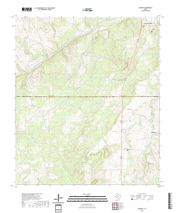
2022 Map of Katemcy
USGS Topo · Published 2022About this map
The San Saba River defines the northern reaches of this Hill Country landscape, carving a path through the rolling terrain along the border of McCulloch and Mason counties. This modern topographic study shows the rural character of the region, centered on the historic settlements of Camp San Saba and Katemcy. The area is characterized by a complex network of seasonal drainages, including Schmidt Br, Cavin Br, and Dry Prong Katemcy Cr, which feed into the larger river system.
Find a feature on this map
40 named features on this map. Tap any name to fly to it.
Don’t see what you’re looking for? This feature index may not catch every label — zoom into the map to look around manually.
Map Details
Editions of this 2022 Katemcy Map
This is the sole edition of this map. No revisions or reprints were ever made.
Other maps of this area

1887 · Mason
USGS Topo · 1:125,000

1894 · Brady
USGS Topo · 1:125,000

1894 · Mason
USGS Topo · 1:125,000

1954 · Brownwood
USGS Topo · 1:250,000

1954 · Llano
USGS Topo · 1:250,000

1955 · Llano
USGS Topo · 1:250,000

1956 · Llano
USGS Topo · 1:250,000

1962 · Purdy Hill
USGS Topo · 1:24,000

1963 · Spy Rock
USGS Topo · 1:24,000
1963 · Voca
USGS Topo · 1:24,000