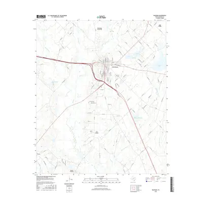
2016 Map of Kaufman
USGS Topo · Published 2016About this map
Kaufman serves as the central hub of this North Texas landscape, where the confluence of several prominent creeks and modern infrastructure meet. The town's grid is detailed with numerous street names including N Washington St and E Mulberry St, reflecting its growth as a regional center. Surrounding the town, the topography is defined by the drainage systems of Kings Cr, Big Brushy Cr, and Prairie Br, which feed into local reservoirs like the Kaufman City Lakes and Kaufman Lake.
Find a feature on this map
120 named features on this map. Tap any name to fly to it.
Don’t see what you’re looking for? This feature index may not catch every label — zoom into the map to look around manually.
Map Details
Editions of this 2016 Kaufman Map
This is the sole edition of this map. No revisions or reprints were ever made.
Other maps of this area

1920 · Kemp
USGS Topo · 1:62,500

1954 · Dallas
USGS Topo · 1:250,000

1956 · Kaufman
USGS Topo · 1:62,500

1957 · Kemp
USGS Topo · 1:62,500

1958 · Dallas
USGS Topo · 1:250,000

1960 · Grays Prairie
USGS Topo · 1:24,000

1961 · Kemp
USGS Topo · 1:24,000

1962 · Elmo
USGS Topo · 1:24,000
1962 · Ola
USGS Topo · 1:24,000
1962 · Scurry
USGS Topo · 1:24,000