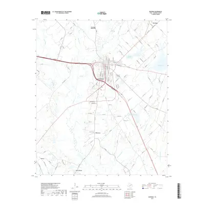
2019 Map of Kaufman
USGS Topo · Published 2019About this map
Kaufman serves as the central hub of this North Texas landscape, where the convergence of State Highway 34 and US Highway 175 shapes the modern character of the county seat. The surrounding countryside is defined by a network of smaller incorporated communities and historic settlements, including Post Oak Bend City, Oak Ridge, and Grays Prairie. The terrain is intricately drained by numerous waterways such as Big Brushy Cr, Kings Cr, and Big Cottonwood Cr, which feed into local reservoirs like the Kaufman City Lakes.
Find a feature on this map
116 named features on this map. Tap any name to fly to it.
Don’t see what you’re looking for? This feature index may not catch every label — zoom into the map to look around manually.
Map Details
Editions of this 2019 Kaufman Map
This is the sole edition of this map. No revisions or reprints were ever made.
Other maps of this area

1920 · Kemp
USGS Topo · 1:62,500

1954 · Dallas
USGS Topo · 1:250,000

1956 · Kaufman
USGS Topo · 1:62,500

1957 · Kemp
USGS Topo · 1:62,500

1958 · Dallas
USGS Topo · 1:250,000

1960 · Grays Prairie
USGS Topo · 1:24,000

1961 · Kemp
USGS Topo · 1:24,000

1962 · Elmo
USGS Topo · 1:24,000
1962 · Ola
USGS Topo · 1:24,000
1962 · Scurry
USGS Topo · 1:24,000