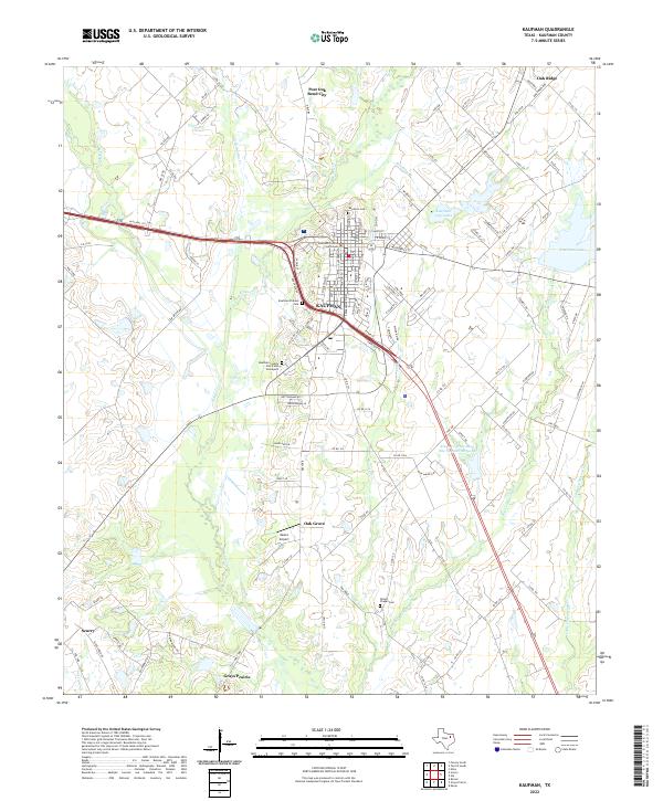
2022 Map of Kaufman
USGS Topo · Published 2022About this map
The Kaufman County Courthouse serves as the central landmark for this Northeast Texas landscape, where the street grid of Kaufman transitions into a network of farm-to-market roads and county lanes. The area's history is preserved in its burial grounds, ranging from the Kaufman Cem north of town to the Kaufman Pioneer Cem and the poignant Kaufman County Poor Farm Graveyard situated to the southwest.
Find a feature on this map
111 named features on this map. Tap any name to fly to it.
Don’t see what you’re looking for? This feature index may not catch every label — zoom into the map to look around manually.
Map Details
Editions of this 2022 Kaufman Map
This is the sole edition of this map. No revisions or reprints were ever made.
Other maps of this area

1920 · Kemp
USGS Topo · 1:62,500

1954 · Dallas
USGS Topo · 1:250,000

1956 · Kaufman
USGS Topo · 1:62,500

1957 · Kemp
USGS Topo · 1:62,500

1958 · Dallas
USGS Topo · 1:250,000

1960 · Grays Prairie
USGS Topo · 1:24,000

1961 · Kemp
USGS Topo · 1:24,000

1962 · Elmo
USGS Topo · 1:24,000
1962 · Ola
USGS Topo · 1:24,000
1962 · Scurry
USGS Topo · 1:24,000