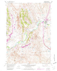
1961 Map of Kaycee
USGS Topo · Published 1982About this map
The Middle Fork Powder River and its companion North Fork Powder River dominate this landscape, illustrating the intricate hydraulic network required for high-plains agriculture. The town of Kaycee sits at the eastern edge, surrounded by a complex system of irrigation infrastructure, including the Vruwink Siphon, a Ditch, and multiple segments of Flume. This 1961 survey, updated with 1981 revisions, documents the enduring ranching heritage of Johnson County through specifically named properties like Gosney Ranch, Thompson Ranch, and Martirena Ranch.
Find a feature on this map
39 named features on this map. Tap any name to fly to it.
Don’t see what you’re looking for? This feature index may not catch every label — zoom into the map to look around manually.
Map Details
Editions of this 1961 Kaycee Map
2 editions found
Other maps of this area

1955 · Arminto
USGS Topo · 1:250,000

1958 · Arminto
USGS Topo · 1:250,000

1961 · Barnum
USGS Topo · 1:62,500

1961 · Kaycee NE
USGS Topo · 1:24,000

1961 · Dry Creek Reservoir
USGS Topo · 1:24,000

1961 · TTT Ranch
USGS Topo · 1:24,000

1961 · Wall Creek
USGS Topo · 1:24,000

1961 · Hibbard Draw
USGS Topo · 1:24,000

1961 · Kaycee
USGS Topo · 1:24,000

1962 · Arminto
USGS Topo · 1:250,000