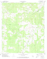
1972 Map of Keatchie
USGS Topo · Published 1974About this map
The Bethany Longstreet Oil and Gas Field dominates the central landscape of this early 1970s survey, marking a period of significant industrial activity across the border of Caddo and De Soto Parishes. The Southern Pacific railroad runs north-to-south through the village of Keatchie, which serves as a local hub for the surrounding rural settlements. Small communities and family-named landmarks are scattered throughout, including Four Forks to the northwest and Kolter to the south.
Find a feature on this map
28 named features on this map. Tap any name to fly to it.
Don’t see what you’re looking for? This feature index may not catch every label — zoom into the map to look around manually.
Map Details
Editions of this 1972 Keatchie Map
This is the sole edition of this map. No revisions or reprints were ever made.
Other maps of this area

1943 · Waskom
USGS Topo · 1:62,500

1945 · Grand Cane
USGS Topo · 1:62,500

1945 · Waskom
USGS Topo · 1:62,500

1945 · Greenwood
USGS Topo · 1:62,500

1945 · Socagee Bayou
USGS Topo · 1:62,500

1955 · Shreveport
USGS Topo · 1:250,000

1955 · Greenwood
USGS Topo · 1:62,500

1956 · Shreveport
USGS Topo · 1:250,000

1956 · Tyler
USGS Topo · 1:250,000

1956 · Deadwood
USGS Topo · 1:62,500