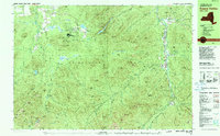
1979 Map of Keene Valley
USGS Topo · Published 1979About this map
Mt Van Hoevenberg Recreational Center serves as a major focal point on this 1979 survey, showcasing a landscape heavily utilized for international winter sports just before the regional spotlight of the 1980 Winter Olympics. The map meticulously labels specialized infrastructure such as the Biathlon Stadium, Luge Run, and Bobled Run, alongside local recreation like the Golf Course. These manmade developments contrast sharply with the surrounding high peaks of the Cascade Range and the Mac Intyre Mountains.
Find a feature on this map
123 named features on this map. Tap any name to fly to it.
Don’t see what you’re looking for? This feature index may not catch every label — zoom into the map to look around manually.
Map Details
Editions of this 1979 Keene Valley Map
2 editions found
Other maps of this area

1894 · Elizabethtown
USGS Topo · 1:62,500

1895 · Elizabethtown
USGS Topo · 1:62,500

1895 · Mt. Marcy
USGS Topo · 1:62,500

1895 · Ausable
USGS Topo · 1:62,500

1896 · Lake Placid
USGS Topo · 1:62,500

1898 · Lake Placid
USGS Topo · 1:62,500

1901 · Elizabethtown
USGS Topo · 1:62,500

1902 · Mt. Marcy
USGS Topo · 1:62,500

1902 · Saranac
USGS Topo · 1:62,500

1903 · Ausable
USGS Topo · 1:62,500