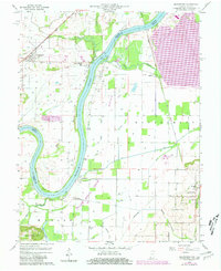
1959 Map of Keensburg
USGS Topo · Published 1981About this map
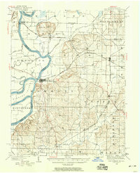
The Wabash River carves a winding path along the state line in this mid-century survey, dividing Wabash Co Illinois from Gibson Co Indiana. The landscape is defined by the river’s alluvial activity, featuring Duck Island and Coffee Island within the main channel, while the surrounding lowlands are dominated by an extensive drainage network including Scott Ditch, Watts Ditch, and Sumner Ditch. On the Illinois side, the Conrail line links the village of Keensburg to the surrounding agricultural fields and oil production zones. Numerous Oil Wells dot the terrain, particularly near Rochester and along the Mc Cleary Bluffs. Genealogists will find significant local value in the documented locations of several burial grounds, such as the Le Gier-Lovellette Cem and Keens Cem. To the southeast in Indiana, the Purdue University Horticultural Farm stands near the quiet settlements of Crawleyville and Jimtown, illustrating the region’s long-standing connection to agricultural research and development.
Find a feature on this map
43 named features on this map. Tap any name to fly to it.
Don’t see what you’re looking for? This feature index may not catch every label — zoom into the map to look around manually.
Map Details
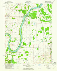
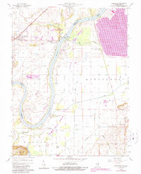
Editions of this 1959 Keensburg Map
Other maps of this area

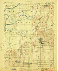
1901 · Princeton
USGS Topo · 1:62,500

1901 · Haubstadt
USGS Topo · 1:62,500

1903 · Haubstadt
USGS Topo · 1:62,500

1903 · New Harmony
USGS Topo · 1:62,500
1903 · Princeton
USGS Topo · 1:62,500

1903 · Patoka
USGS Topo · 1:125,000

1904 · Mount Carmel
USGS Topo · 1:62,500
1938 · New Harmony
USGS Topo · 1:62,500

1956 · Vincennes
USGS Topo · 1:250,000

1957 · Vincennes
USGS Topo · 1:250,000