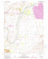
1959 Map of Keensburg
USGS Topo · Published 1989About this map
Wabash River meanders through this borderland where Illinois and Indiana meet, shaping a landscape of fertile bottomlands and complex drainage systems. The survey reveals a rural economy heavily influenced by the river's path, featuring protective structures like the levee near Mc Cleary Bluffs. Notable for its mixture of agriculture and preservation, the area includes the Beall Woods State Conservation and Natural Area, which stands in contrast to the numerous oil wells dotting the surrounding fields.
Find a feature on this map
36 named features on this map. Tap any name to fly to it.
Don’t see what you’re looking for? This feature index may not catch every label — zoom into the map to look around manually.
Map Details
Editions of this 1959 Keensburg Map
Other maps of this area

1901 · Princeton
USGS Topo · 1:62,500

1901 · Haubstadt
USGS Topo · 1:62,500

1903 · Haubstadt
USGS Topo · 1:62,500

1903 · New Harmony
USGS Topo · 1:62,500

1903 · Princeton
USGS Topo · 1:62,500

1903 · Patoka
USGS Topo · 1:125,000

1904 · Mount Carmel
USGS Topo · 1:62,500

1938 · New Harmony
USGS Topo · 1:62,500

1956 · Vincennes
USGS Topo · 1:250,000

1957 · Vincennes
USGS Topo · 1:250,000