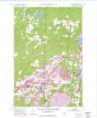
1952 Map of Keewatin
USGS Topo · Published 1977About this map
Iron ore extraction dominates the landscape across the boundary of Itasca and St. Louis counties during this mid-century period. The town of Keewatin serves as a central hub, flanked by an intensive network of open pits, tailings ponds, and mine dumps that reshaped the local topography. In the settlement of Mine Village, the residential pattern is physically integrated with the operations of the Mississippi No 1 Mine and the Bennett Mine.
Find a feature on this map
45 named features on this map. Tap any name to fly to it.
Don’t see what you’re looking for? This feature index may not catch every label — zoom into the map to look around manually.
Map Details
Editions of this 1952 Keewatin Map
4 editions found
Other maps of this area

1951 · Hibbing
USGS Topo · 1:24,000

1952 · Keewatin
USGS Topo · 1:24,000

1952 · Riley
USGS Topo · 1:24,000

1952 · Nashwauk
USGS Topo · 1:24,000

1952 · Silica
USGS Topo · 1:24,000

1952 · Pengilly
USGS Topo · 1:24,000

1954 · Hibbing
USGS Topo · 1:250,000

1955 · Dewey Lake
USGS Topo · 1:24,000

1957 · Hibbing
USGS Topo · 1:250,000

1957 · Hibbing
USGS Topo · 1:24,000