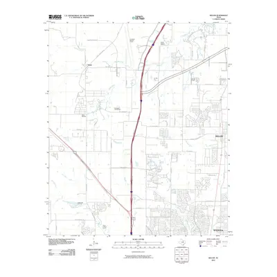
2010 Map of Keller
USGS Topo · Published 2010About this map
The northern suburbs of Fort Worth are characterized by rapid residential expansion and significant aviation infrastructure in this 2010 survey. The North Fwy corridor serves as the primary spine for development, connecting the residential hubs of Keller and Watauga with the industrial and logistics centers to the west. A high concentration of aviation facilities defines the local economy and land use, ranging from the massive Fort Worth Alliance Airport to smaller strips like Hillcrest Airport and the Circle C Ranch Airport.
Find a feature on this map
52 named features on this map. Tap any name to fly to it.
Don’t see what you’re looking for? This feature index may not catch every label — zoom into the map to look around manually.
Map Details
Editions of this 2010 Keller Map
This is the sole edition of this map. No revisions or reprints were ever made.
Other maps of this area

1894 · Fort Worth
USGS Topo · 1:125,000

1931 · Grapevine
USGS Topo · 1:62,500

1954 · Dallas
USGS Topo · 1:250,000

1954 · Sherman
USGS Topo · 1:250,000

1955 · Haltom City
USGS Topo · 1:24,000

1955 · Avondale
USGS Topo · 1:24,000

1955 · Keller
USGS Topo · 1:24,000

1955 · Lake Worth
USGS Topo · 1:24,000

1955 · Haltom City
USGS Topo · 1:62,500

1958 · Dallas
USGS Topo · 1:250,000