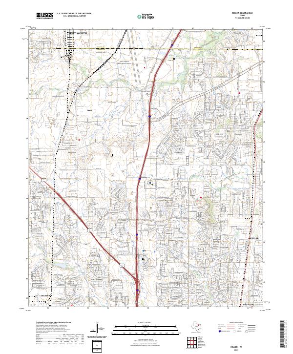
2023 Map of Keller
USGS Topo · Published 2023About this map
The northern edge of Fort Worth and the surrounding suburban expansion into Denton and Tarrant counties are documented in this 2023 survey. This landscape is defined by the massive infrastructure of Perot Field/Fort Worth Alliance Airport and the complex transportation corridors of the Alliance Gateway Fwy and Intermodal Pkwy. Amidst this rapid commercial and residential development, small pockets of early history remain visible, including the Allen Cem, Peterson Family Cem, and Chapel Cem. The map traces the growth of established communities like Haslet, Blue Mound, and Saginaw, showing how contemporary residential subdivisions have filled the spaces between historic waterways such as Henrietta Creek, Buffalo Creek, and Big Bear Creek.
Find a feature on this map
65 named features on this map. Tap any name to fly to it.
Don’t see what you’re looking for? This feature index may not catch every label — zoom into the map to look around manually.
Map Details
Editions of this 2023 Keller Map
This is the sole edition of this map. No revisions or reprints were ever made.
Other maps of this area

1894 · Fort Worth
USGS Topo · 1:125,000

1931 · Grapevine
USGS Topo · 1:62,500

1954 · Dallas
USGS Topo · 1:250,000

1954 · Sherman
USGS Topo · 1:250,000

1955 · Haltom City
USGS Topo · 1:24,000

1955 · Avondale
USGS Topo · 1:24,000

1955 · Keller
USGS Topo · 1:24,000

1955 · Lake Worth
USGS Topo · 1:24,000

1955 · Haltom City
USGS Topo · 1:62,500

1958 · Dallas
USGS Topo · 1:250,000