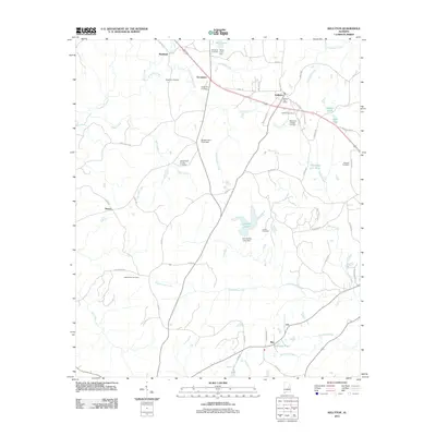
2011 Map of Kellyton
USGS Topo · Published 2011About this map
Kellyton serves as a central hub in this Tallapoosa County landscape, marked by the Kellyton Post Office and a network of county roads including Co HWY-77 and Co HWY-49. The area is defined by numerous family and community burial grounds, such as the Socapatoy Cemetery, Bradford Cemetery, and the Doctor Kellys Private Cemetery, which provide significant touchstones for genealogical research. The terrain is intricately carved by a dense drainage system, where Socapatoy Creek and Little Socapatoy Creek flow toward the larger Elkahatchee Creek. Smaller settlements like Bradford, Socapatoy, and Ray are interspersed with agricultural features like Brooks Farm Pond Dam and Ann Jordan Lake Dam. This 2011 survey reflects the rural character of the region, where historical landmarks like New Shiloh Cemetery and names like 5 Star Plantation persist alongside modern local routes, illustrating the continued significance of land ownership and local heritage in central Alabama.
Find a feature on this map
67 named features on this map. Tap any name to fly to it.
Don’t see what you’re looking for? This feature index may not catch every label — zoom into the map to look around manually.
Map Details
Editions of this 2011 Kellyton Map
This is the sole edition of this map. No revisions or reprints were ever made.
Other maps of this area

1890 · Talladega
USGS Topo · 1:125,000

1891 · Ashland
USGS Topo · 1:125,000

1892 · Talladega
USGS Topo · 1:125,000

1901 · Wetumpka
USGS Topo · 1:125,000

1903 · Wetumpka
USGS Topo · 1:125,000

1906 · Dadeville
USGS Topo · 1:125,000

1944 · Goodwater
USGS Topo · 1:62,500

1947 · Goodwater
USGS Topo · 1:62,500

1953 · Montgomery
USGS Topo · 1:250,000

1953 · Birmingham
USGS Topo · 1:250,000