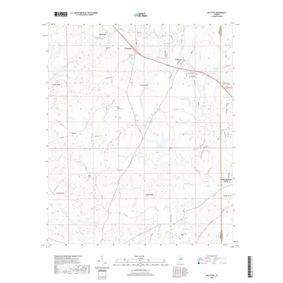
2018 Map of Kellyton
USGS Topo · Published 2018About this map
Alexander City borders the southeastern edge of this terrain where the Coosa and Tallapoosa county line defines the rural landscape. The area is characterized by a dense network of watercourses, including Elkahatchee Creek and Socapatoy Creek, which provide the drainage for numerous small ponds such as Dunnings Pond and Nibletts Pond. The settlement pattern reflects a deeply rooted community history, anchored by several historic cemeteries such as Bradford Cem and Socapatoy Cem.
Find a feature on this map
82 named features on this map. Tap any name to fly to it.
Don’t see what you’re looking for? This feature index may not catch every label — zoom into the map to look around manually.
Map Details
Editions of this 2018 Kellyton Map
This is the sole edition of this map. No revisions or reprints were ever made.
Other maps of this area

1890 · Talladega
USGS Topo · 1:125,000

1891 · Ashland
USGS Topo · 1:125,000

1892 · Talladega
USGS Topo · 1:125,000

1901 · Wetumpka
USGS Topo · 1:125,000

1903 · Wetumpka
USGS Topo · 1:125,000

1906 · Dadeville
USGS Topo · 1:125,000
1944 · Goodwater
USGS Topo · 1:62,500
1947 · Goodwater
USGS Topo · 1:62,500

1953 · Montgomery
USGS Topo · 1:250,000

1953 · Birmingham
USGS Topo · 1:250,000