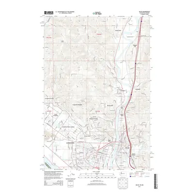
2013 Map of Kelso
USGS Topo · Published 2013About this map
Longview and Kelso anchor this riverfront landscape at the confluence of the Cowlitz River and the Columbia River. The map reveals the sophisticated urban planning of central Longview, defined by the winding waters of Lake Sacajawea and the established neighborhoods of Columbia Valley Gardens and Huntington Rock. Beyond the industrial and commercial core, the terrain rises into residential hillsides including Beacon Hill, Columbia Heights, and Longview Heights. Significant hydrological features like Ditch Number Five and Ditch Number Three manage the low-lying areas near Mt Coffin, while the northern reaches of the quadrangle show the rural character of Goose Hollow and Sandy Bend. The eastern edge is shaped by the Coweeman River and the rail-oriented development at Ostrander, providing a detailed view of the infrastructure supporting this vital Washington timber and transit hub.
Find a feature on this map
175 named features on this map. Tap any name to fly to it.
Don’t see what you’re looking for? This feature index may not catch every label — zoom into the map to look around manually.
Map Details
Editions of this 2013 Kelso Map
This is the sole edition of this map. No revisions or reprints were ever made.
Other maps of this area

1919 · Mayger
USGS Topo · 1:62,500

1921 · Kalama
USGS Topo · 1:62,500

1941 · Olequa
USGS Topo · 1:62,500

1941 · Clatskanie
USGS Topo · 1:62,500

1952 · Clatskanie
USGS Topo · 1:62,500

1953 · Hoquiam
USGS Topo · 1:250,000

1953 · Castle Rock
USGS Topo · 1:62,500

1953 · Mt. Brynion
USGS Topo · 1:24,000

1953 · Ryderwood
USGS Topo · 1:62,500

1953 · Rainier
USGS Topo · 1:24,000