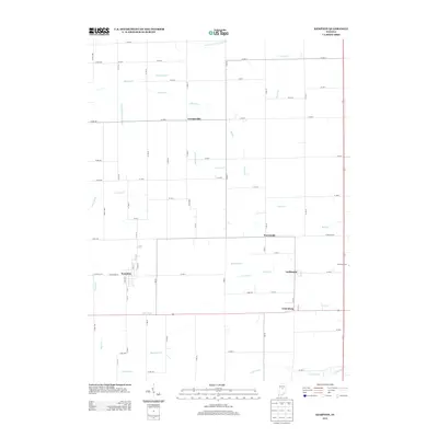
2013 Map of Kempton
USGS Topo · Published 2013About this map
Kempton and Goldsmith anchor this agricultural landscape in Tipton County, where the geometric grid of county roads defines the rural economy of the early 21st century. The map illustrates a meticulously managed watershed, where natural watercourses like Shanty Cr and Broad Cr are augmented by an extensive network of drainage features such as Lydy-Fillenworth Ditch and Kemp Ditch. This reliance on channelized drainage reveals the historical necessity of reclaiming the fertile midwestern soil for high-yield farming. Smaller settlements like Tetersburg, Normanda, and Groomsville are scattered throughout the quadrangle, connected by a network of thoroughfares including W Railroad St and W Division Rd. The presence of Fernung Farms further emphasizes the continued importance of organized agriculture in this part of Indiana, while the headwaters of Sugar Cr and Cicero Cr mark the subtle topographic divides across the plains.
Find a feature on this map
54 named features on this map. Tap any name to fly to it.
Don’t see what you’re looking for? This feature index may not catch every label — zoom into the map to look around manually.
Map Details
Editions of this 2013 Kempton Map
This is the sole edition of this map. No revisions or reprints were ever made.
Other maps of this area

1953 · Danville
USGS Topo · 1:250,000

1955 · Danville
USGS Topo · 1:250,000

1956 · Danville
USGS Topo · 1:250,000

1960 · Kokomo West
USGS Topo · 1:24,000

1960 · Kokomo East
USGS Topo · 1:24,000

1960 · Kempton
USGS Topo · 1:24,000

1960 · Tipton
USGS Topo · 1:24,000

1961 · Russiaville
USGS Topo · 1:24,000

1961 · Sheridan
USGS Topo · 1:24,000

1961 · Hillisburg
USGS Topo · 1:24,000