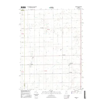
2016 Map of Kempton
USGS Topo · Published 2016About this map
Agricultural lands and engineered waterways define this section of the Indiana heartland near the Tipton and Clinton County border. Small rural communities like Kempton and Goldsmith are tied together by a precise grid of county roads and a central rail line. The landscape is characterized by an extensive network of drainage features such as Collier Ditch, Kemp Ditch, and Magnet Ditch, which were historically essential for converting these flat wetlands into productive farmland. Several small cemeteries, including Tucker Cem and Wolford Cem, are scattered across the quadrangle, marking the generational presence of farming families in the area. The terrain transitions between the headwaters of several regional stream systems, including Kilmore Cr flowing to the west and Cicero Cr draining toward the southeast, illustrating the subtle topographic shifts of the central Indiana till plain.
Find a feature on this map
123 named features on this map. Tap any name to fly to it.
Don’t see what you’re looking for? This feature index may not catch every label — zoom into the map to look around manually.
Map Details
Editions of this 2016 Kempton Map
This is the sole edition of this map. No revisions or reprints were ever made.
Other maps of this area

1953 · Danville
USGS Topo · 1:250,000

1955 · Danville
USGS Topo · 1:250,000

1956 · Danville
USGS Topo · 1:250,000

1960 · Kokomo West
USGS Topo · 1:24,000

1960 · Kokomo East
USGS Topo · 1:24,000

1960 · Kempton
USGS Topo · 1:24,000

1960 · Tipton
USGS Topo · 1:24,000

1961 · Russiaville
USGS Topo · 1:24,000

1961 · Sheridan
USGS Topo · 1:24,000

1961 · Hillisburg
USGS Topo · 1:24,000