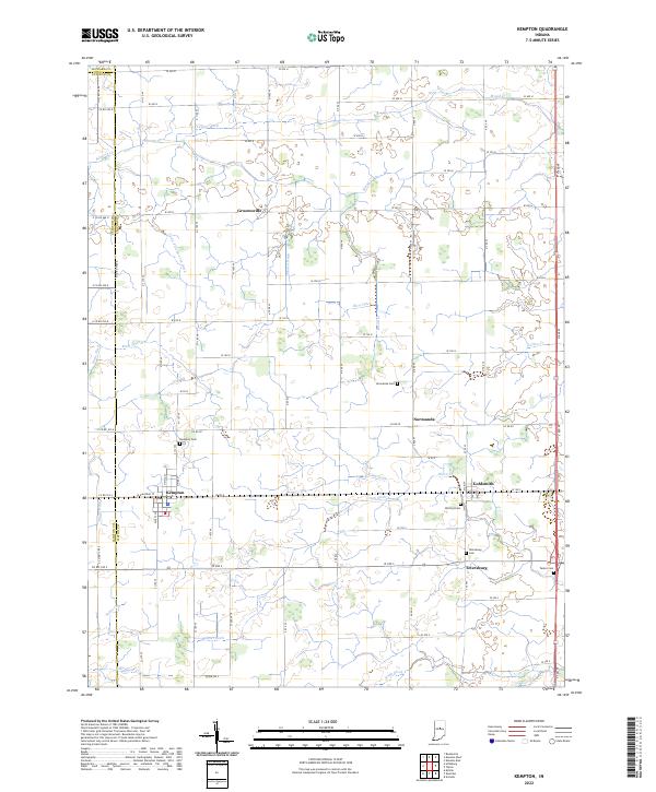
2022 Map of Kempton
USGS Topo · Published 2022About this map
Kempton and Goldsmith anchor this agricultural landscape in Tipton County, where the transition between the T21N and T22N townships reveals a highly organized network of drainage ditches essential to Indiana's farming heritage. The map documents numerous water management features like Carter Ditch, Collier Ditch, and Judy-Fillenworth Ditch, which channel water toward natural streams such as Sugar Cr and Cicero Cr. Smaller settlements like Groomsville, Normanda, and Tetersburg remain central to the rural identity of the area.
Find a feature on this map
96 named features on this map. Tap any name to fly to it.
Don’t see what you’re looking for? This feature index may not catch every label — zoom into the map to look around manually.
Map Details
Editions of this 2022 Kempton Map
This is the sole edition of this map. No revisions or reprints were ever made.
Other maps of this area

1953 · Danville
USGS Topo · 1:250,000

1955 · Danville
USGS Topo · 1:250,000

1956 · Danville
USGS Topo · 1:250,000

1960 · Kokomo West
USGS Topo · 1:24,000

1960 · Kokomo East
USGS Topo · 1:24,000

1960 · Kempton
USGS Topo · 1:24,000

1960 · Tipton
USGS Topo · 1:24,000

1961 · Russiaville
USGS Topo · 1:24,000

1961 · Sheridan
USGS Topo · 1:24,000

1961 · Hillisburg
USGS Topo · 1:24,000