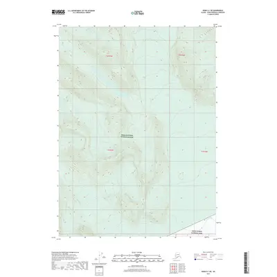
2017 Map of Kenai A-1 NE
USGS Topo · Published 2017About this map
Kenai National Wildlife Refuge dominates this section of the Kenai Peninsula, showcasing a landscape defined by glacial activity and high-altitude water systems. The massive Skilak Glacier and Killey Glacier serve as the primary topographical drivers of the region, feeding the Killey River and forming elevated bodies of water such as Iceberg Lake. The transition from the wildlife refuge into Kenai Fjords National Park at the southeastern corner highlights the intersection of two major protected wilderness areas. This 2017 survey provides a precise view of the drainage patterns and ice-field margins within the borough, reflecting the modern state of these protected interior lands before further environmental shifts.
Find a feature on this map
10 named features on this map. Tap any name to fly to it.
Don’t see what you’re looking for? This feature index may not catch every label — zoom into the map to look around manually.
Map Details
Editions of this 2017 Kenai A-1 NE Map
This is the sole edition of this map. No revisions or reprints were ever made.
Other maps of this area

1944 · Kenai
USGS Topo · 1:250,000

1950 · Kenai
USGS Topo · 1:250,000

1950 · Kenai B-1
USGS Topo · 1:63,360

1950 · Seward A-8
USGS Topo · 1:63,360

1951 · Seward
USGS Topo · 1:250,000

1951 · Kenai A-1
USGS Topo · 1:63,360

1951 · Seward B-8
USGS Topo · 1:63,360

1951 · Seward A-8
USGS Topo · 1:63,360
1952 · Seward A-8
USGS Topo · 1:63,360

1952 · Kenai A-1
USGS Topo · 1:63,360