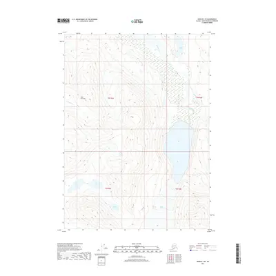
2017 Map of Kenai B-1 SE
USGS Topo · Published 2017About this map
Glacial melt and high-altitude hydrology define this portion of the Kenai Peninsula, where the Skilak River emerges from the ice-carved interior. The southern edge of the sheet is dominated by the Skilak Glacier, a massive feature that feeds the surrounding watershed and the river that bears its name. This landscape is a complex network of isolated water bodies, ranging from the high-elevation Alpine Lake to the uniquely situated Pothole Lake and the paired basins of Twin Lakes.
Find a feature on this map
11 named features on this map. Tap any name to fly to it.
Don’t see what you’re looking for? This feature index may not catch every label — zoom into the map to look around manually.
Map Details
Editions of this 2017 Kenai B-1 SE Map
This is the sole edition of this map. No revisions or reprints were ever made.
Other maps of this area

1944 · Kenai
USGS Topo · 1:250,000

1950 · Kenai
USGS Topo · 1:250,000

1950 · Kenai B-1
USGS Topo · 1:63,360

1950 · Seward A-8
USGS Topo · 1:63,360

1951 · Seward
USGS Topo · 1:250,000

1951 · Kenai A-1
USGS Topo · 1:63,360

1951 · Seward B-8
USGS Topo · 1:63,360

1951 · Seward A-8
USGS Topo · 1:63,360
1952 · Seward A-8
USGS Topo · 1:63,360

1952 · Kenai A-1
USGS Topo · 1:63,360