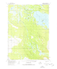
1951 Map of Kenai B-2
USGS Topo · Published 1977About this map
The Kenai National Moose Range dominates this landscape, showing the wild river systems of the central Kenai Peninsula as they were mapped in the early 1950s. The mighty Kenai River flows through the northern reaches, connecting the expansive waters of Skilak Lake to the broader territory. This survey captures a transition point in Alaskan conservation history, marking the Skilak Guard Station near where the river exits the lake. The terrain is a complex network of glacial and runoff waters, including the Killey River, Funny River, and numerous smaller bodies like Hunters Lake and Browns Lake. Small Cabin sites are scattered along the shorelines of these remote lakes, while the Caribou Islands and the uniquely named Frying Pan Island provide distinctive landmarks within the larger lake. This map preserves the early post-war topography of a region defined by its moose habitat and freshwater arteries.
Find a feature on this map
28 named features on this map. Tap any name to fly to it.
Don’t see what you’re looking for? This feature index may not catch every label — zoom into the map to look around manually.
Map Details
Editions of this 1951 Kenai B-2 Map
5 editions found
Other maps of this area

1944 · Kenai
USGS Topo · 1:250,000

1950 · Kenai
USGS Topo · 1:250,000

1950 · Kenai C-3
USGS Topo · 1:63,360

1950 · Kenai B-1
USGS Topo · 1:63,360

1950 · Kenai B-3
USGS Topo · 1:63,360

1951 · Kenai B-2
USGS Topo · 1:63,360

1951 · Kenai C-1
USGS Topo · 1:63,360

1951 · Kenai C-2
USGS Topo · 1:63,360

1951 · Kenai A-3
USGS Topo · 1:63,360

1951 · Kenai A-2
USGS Topo · 1:63,360