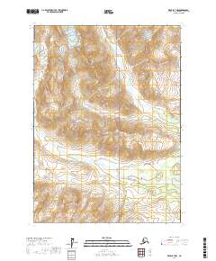
2017 Map of Kenai B-7 NW
USGS Topo · Published 2017About this map
Lake Clark National Park encompasses much of this wilderness region within the Kenai Peninsula Borough, where the terrain is defined by the drainage basins of two major waterways. Harriet Creek flows through the northeastern sections, while Redoubt Creek cuts across the central and southern portions of the landscape. The map provides a detailed view of the Public Land Survey System grid, including townships t4n r19w and t5n r18w, which organize this largely uninhabited territory. The elevation contours reveal the complex alpine topography typical of this part of Alaska, illustrating the high ridges and deep valleys that dictate the course of Harriet Cr and its tributaries before they reach the Cook Inlet region.
Find a feature on this map
11 named features on this map. Tap any name to fly to it.
Don’t see what you’re looking for? This feature index may not catch every label — zoom into the map to look around manually.
Map Details
Editions of this 2017 Kenai B-7 NW Map
This is the sole edition of this map. No revisions or reprints were ever made.
Other maps of this area

1944 · Kenai
USGS Topo · 1:250,000

1950 · Kenai
USGS Topo · 1:250,000

1958 · Kenai B-7
USGS Topo · 1:63,360

1958 · Kenai B-8
USGS Topo · 1:63,360

1958 · Kenai C-8
USGS Topo · 1:63,360

1958 · Kenai C-7
USGS Topo · 1:63,360

1958 · Kenai
USGS Topo · 1:250,000
2017 · Kenai B-8 NE
USGS Topo · 1:25,000
2017 · Kenai C-7 SW
USGS Topo · 1:25,000
2017 · Kenai C-7 SE
USGS Topo · 1:25,000