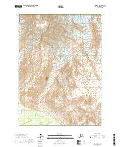
2017 Map of Kenai B-8 NE
USGS Topo · Published 2017About this map
Redoubt Volcano dominates the northern reaches of this topographic study, its high-altitude contours mapping the formidable relief of this Alaskan peak. Much of the surrounding landscape is protected territory, falling within the official boundaries of Lake Clark National Park. The terrain is defined by dramatic drainage systems, including the headwaters of Redoubt Creek and the meandering North Fork Crescent River in the southwestern corner. These watercourses are vital indicators of the local drainage patterns and glaciated valleys that characterize the Kenai Peninsula’s wilderness. The map provides precise Public Land Survey System data, marking townships such as t5n r20w and t4n r19w, which aid in locating specific geographic coordinates within this roadless and undeveloped terrain.
Find a feature on this map
10 named features on this map. Tap any name to fly to it.
Don’t see what you’re looking for? This feature index may not catch every label — zoom into the map to look around manually.
Map Details
Editions of this 2017 Kenai B-8 NE Map
This is the sole edition of this map. No revisions or reprints were ever made.
Other maps of this area

1944 · Kenai
USGS Topo · 1:250,000

1950 · Kenai
USGS Topo · 1:250,000

1958 · Kenai B-7
USGS Topo · 1:63,360

1958 · Kenai B-8
USGS Topo · 1:63,360

1958 · Kenai C-8
USGS Topo · 1:63,360

1958 · Kenai C-7
USGS Topo · 1:63,360

1958 · Kenai
USGS Topo · 1:250,000
2017 · Kenai C-7 SW
USGS Topo · 1:25,000
2017 · Kenai B-8 NW
USGS Topo · 1:25,000
2017 · Kenai C-8 SW
USGS Topo · 1:25,000