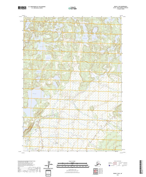
2024 Map of Kenai C-2 NE
USGS Topo · Published 2024About this map
The Kenai National Wildlife Refuge dominates this section of the Kenai Peninsula, where a complex network of glacial kettle lakes and wetlands defines the northern landscape. Much of the southern half is preserved as the Kenai Wilderness (Dave Spencer Unit), characterized by the meandering path of the Moose River as it flows through extensive marshy lowlands. This territory is a primary corridor for non-motorized travel, highlighted by the Swan Lake Canoe Route, which connects numerous named water bodies including Swan Lake, Raven Lake, and Portage Lakes. Infrastructure is sparse in this protected area, with Swan Lake Road providing the primary land access to the northwest corner near Duckling Lake. The map illustrates the specialized water-based transportation system required to navigate this portion of the peninsula, where dry ground is the exception rather than the rule.
Find a feature on this map
26 named features on this map. Tap any name to fly to it.
Don’t see what you’re looking for? This feature index may not catch every label — zoom into the map to look around manually.
Map Details
Editions of this 2024 Kenai C-2 NE Map
This is the sole edition of this map. No revisions or reprints were ever made.
Other maps of this area

1944 · Kenai
USGS Topo · 1:250,000

1950 · Kenai
USGS Topo · 1:250,000

1951 · Kenai C-1
USGS Topo · 1:63,360

1951 · Kenai C-2
USGS Topo · 1:63,360

1951 · Kenai D-1
USGS Topo · 1:63,360

1951 · Kenai D-2
USGS Topo · 1:63,360

1952 · Kenai D-2
USGS Topo · 1:63,360

1952 · Kenai C-1
USGS Topo · 1:63,360

1952 · Kenai C-2
USGS Topo · 1:63,360
1952 · Kenai D-1
USGS Topo · 1:63,360