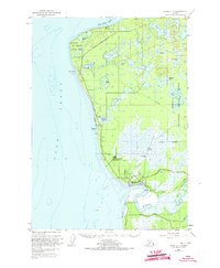
1951 Map of Kenai C-4
USGS Topo · Published 1973About this map
The Kenai River flows into the Cook Inlet at the heart of this 1950s-era coastal survey, revealing a landscape defined by its maritime and early aviation infrastructure. The settlement of Kenai sits positioned at the river's mouth, supported by the nearby Kenai Airport and several communication landmarks like the Radio Range Station. Along the coast, the East Foreland Lighthouse and Nikiski Wharf emphasize the importance of the inlet for regional transport. Inland, the terrain is characterized by a dense network of lakes, including Daniels Lake, Salamatof Lake, and Island Lake, interspersed within the protected boundaries of the Kenai National Moose Range. This map documents a transitional period for the Kenai Peninsula, where older sites like the Salamatof Site and a Sawmill coexist with more modern developments like Wildwood Station and the emerging North Kenai Road network.
Find a feature on this map
49 named features on this map. Tap any name to fly to it.
Don’t see what you’re looking for? This feature index may not catch every label — zoom into the map to look around manually.
Map Details
Editions of this 1951 Kenai C-4 Map
3 editions found
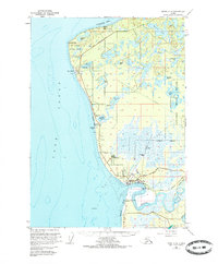
Other maps of this area

1944 · Kenai
USGS Topo · 1:250,000

1950 · Kenai
USGS Topo · 1:250,000

1950 · Kenai C-3
USGS Topo · 1:63,360

1950 · Kenai B-3
USGS Topo · 1:63,360

1950 · Kenai D-4
USGS Topo · 1:63,360

1951 · Kenai D-3
USGS Topo · 1:63,360

1951 · Kenai C-4
USGS Topo · 1:63,360

1951 · Kenai C-3
USGS Topo · 1:63,360

1951 · Kenai B-4
USGS Topo · 1:63,360

1952 · Kenai D-3
USGS Topo · 1:63,360