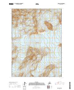
2017 Map of Kenai C-8 NE
USGS Topo · Published 2017About this map
The high-altitude terrain of the Aleutian Range dominates this portion of the Kenai Peninsula, where steep glacial valleys and sharp ridgelines define the landscape. Much of this territory is preserved within Lake Clark National Park, a protected expanse where human infrastructure is entirely absent in favor of natural features. The most significant ice feature shown is the Double Glacier, which occupies the eastern drainage of these mountains. The map illustrates a primitive wilderness state, documented by the U.S. Geological Survey during a period of modern glacial monitoring. The layout of the township and range lines, such as t7n r20w, serves as the only formal grid over a region shaped primarily by shifting ice and geological activity.
Find a feature on this map
9 named features on this map. Tap any name to fly to it.
Don’t see what you’re looking for? This feature index may not catch every label — zoom into the map to look around manually.
Map Details
Editions of this 2017 Kenai C-8 NE Map
This is the sole edition of this map. No revisions or reprints were ever made.
Other maps of this area

1944 · Kenai
USGS Topo · 1:250,000

1950 · Kenai
USGS Topo · 1:250,000

1958 · Kenai D-8
USGS Topo · 1:63,360

1958 · Kenai C-8
USGS Topo · 1:63,360

1958 · Kenai D-7
USGS Topo · 1:63,360

1958 · Kenai C-7
USGS Topo · 1:63,360

1958 · Kenai
USGS Topo · 1:250,000
2017 · Kenai C-7 SW
USGS Topo · 1:25,000
2017 · Kenai D-8 SW
USGS Topo · 1:25,000
2017 · Kenai C-8 NW
USGS Topo · 1:25,000