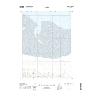
2017 Map of Kenai D-1 NE
USGS Topo · Published 2017About this map
Chickaloon Bay dominates the central landscape of this Kenai Peninsula region, where the tidal waters of the Pacific Ocean reach deep into the Alaskan coastline. This 2017 survey captures the dynamic transition between marine and terrestrial environments, particularly where the Chickaloon River meets the bay. To the north, the waters of Turnagain Arm shape the shoreline, illustrating the complex geography of the Cook Inlet area. The map primarily documents a natural wilderness within the Kenai Peninsula Borough, defined by its intricate hydrography and coastal drainage patterns rather than human infrastructure. Researchers can trace the path of the river as it winds through the southern reaches, providing a clear record of the area's shoreline and water levels as they stood in the early 21st century.
Find a feature on this map
8 named features on this map. Tap any name to fly to it.
Don’t see what you’re looking for? This feature index may not catch every label — zoom into the map to look around manually.
Map Details
Editions of this 2017 Kenai D-1 NE Map
This is the sole edition of this map. No revisions or reprints were ever made.
Other maps of this area

1944 · Kenai
USGS Topo · 1:250,000

1949 · Tyonek
USGS Topo · 1:250,000

1950 · Kenai
USGS Topo · 1:250,000

1951 · Seward
USGS Topo · 1:250,000

1951 · Anchorage
USGS Topo · 1:250,000

1951 · Tyonek
USGS Topo · 1:250,000

1951 · Kenai D-1
USGS Topo · 1:63,360

1951 · Seward D-8
USGS Topo · 1:63,360

1951 · Tyonek A-1
USGS Topo · 1:63,360

1952 · Tyonek A-1
USGS Topo · 1:63,360