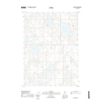
2017 Map of Kenai D-1 SW
USGS Topo · Published 2017About this map
The Swanson River winds through this section of the northern Kenai Peninsula, carving a path through a landscape defined by an intricate network of interconnected freshwater bodies. This 2017 survey details a remote wetland environment where large lakes like King Lake and Barbara Lake dominate the terrain. The hydrology of the region is further characterized by numerous smaller, distinct basins such as Shoepac Lake, Sportfish Lake, and Crooked Lake, reflecting the post-glacial geography of the borough. Settlement is virtually non-existent here, with the map serving as a primary record of the natural topography and the township and range boundaries of t9n r6w, t9n r5w, t8n r6w, and t8n r5w. This area represents a preserved wilderness where the drainage patterns of Grouse Lake and Moose Lake provide critical habitat and a snapshot of the Alaskan interior's untouched aquatic systems.
Find a feature on this map
13 named features on this map. Tap any name to fly to it.
Don’t see what you’re looking for? This feature index may not catch every label — zoom into the map to look around manually.
Map Details
Editions of this 2017 Kenai D-1 SW Map
This is the sole edition of this map. No revisions or reprints were ever made.
Other maps of this area

1944 · Kenai
USGS Topo · 1:250,000

1950 · Kenai
USGS Topo · 1:250,000

1951 · Kenai C-1
USGS Topo · 1:63,360

1951 · Kenai C-2
USGS Topo · 1:63,360

1951 · Kenai D-1
USGS Topo · 1:63,360

1951 · Kenai D-2
USGS Topo · 1:63,360

1952 · Kenai D-2
USGS Topo · 1:63,360

1952 · Kenai C-1
USGS Topo · 1:63,360

1952 · Kenai C-2
USGS Topo · 1:63,360
1952 · Kenai D-1
USGS Topo · 1:63,360