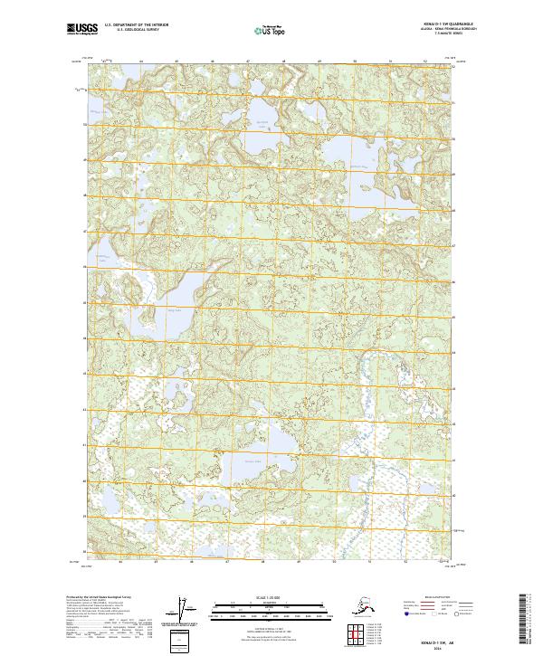
2024 Map of Kenai D-1 SW
USGS Topo · Published 2024About this map
The Kenai National Wildlife Refuge dominates this section of the peninsula, characterized by an intricate network of interconnected wetlands and glacial lakes. This 2024 survey documents the Kenai Wilderness (Dave Spencer Unit), where the Swanson River meanders through a landscape largely defined by its hydrography rather than human infrastructure. Named water bodies such as King Lake, Grouse Lake, and Moose Lake are interspersed among unnamed smaller basins and marshlands, illustrating the complex drainage patterns of the Kenai lowlands. The absence of roads or established settlements emphasizes the protected nature of this wilderness area, making the map a essential reference for understanding the modern geography of Alaska's conservation lands.
Find a feature on this map
14 named features on this map. Tap any name to fly to it.
Don’t see what you’re looking for? This feature index may not catch every label — zoom into the map to look around manually.
Map Details
Editions of this 2024 Kenai D-1 SW Map
This is the sole edition of this map. No revisions or reprints were ever made.
Other maps of this area

1944 · Kenai
USGS Topo · 1:250,000

1950 · Kenai
USGS Topo · 1:250,000

1951 · Kenai C-1
USGS Topo · 1:63,360

1951 · Kenai C-2
USGS Topo · 1:63,360

1951 · Kenai D-1
USGS Topo · 1:63,360

1951 · Kenai D-2
USGS Topo · 1:63,360

1952 · Kenai D-2
USGS Topo · 1:63,360

1952 · Kenai C-1
USGS Topo · 1:63,360

1952 · Kenai C-2
USGS Topo · 1:63,360
1952 · Kenai D-1
USGS Topo · 1:63,360