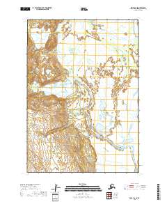
2018 Map of Kenai D-6 NE
USGS Topo · Published 2018About this map
The Kustatan River carves a complex, multi-channeled path through the wetlands of the western Kenai Peninsula, dominating this 2018 coastal study. As it winds toward the Cook Inlet, the river is fed by tributaries including Blacksand Cr, which flows from the elevated terrain to the west. The landscape is defined by the shifting hydrology of these glacial-fed systems, where broad alluvial plains and intricate drainage patterns suggest a terrain in constant flux. The lack of man-made structures on this sheet emphasizes the raw, natural state of the Alaskan shoreline, where the intersection of freshwater runoff and coastal tides dictates the local geography. Surveyed through the National Hydrography Dataset, this map provides a precise look at the river's course through the Kenai Peninsula Borough, including the surveyed townships of T10N R15W and T11N R15W.
Find a feature on this map
8 named features on this map. Tap any name to fly to it.
Don’t see what you’re looking for? This feature index may not catch every label — zoom into the map to look around manually.
Map Details
Editions of this 2018 Kenai D-6 NE Map
This is the sole edition of this map. No revisions or reprints were ever made.
Other maps of this area

1944 · Kenai
USGS Topo · 1:250,000

1949 · Tyonek
USGS Topo · 1:250,000

1950 · Kenai
USGS Topo · 1:250,000

1951 · Tyonek
USGS Topo · 1:250,000

1958 · Tyonek A-6
USGS Topo · 1:63,360

1958 · Tyonek A-5
USGS Topo · 1:63,360

1958 · Kenai D-5
USGS Topo · 1:63,360

1958 · Kenai D-6
USGS Topo · 1:63,360

1958 · Tyonek
USGS Topo · 1:250,000

1958 · Kenai
USGS Topo · 1:250,000