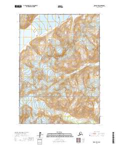
2017 Map of Kenai D-7 NE
USGS Topo · Published 2017About this map
Lake Clark National Park anchors the southern portion of this 2017 survey, where the extreme topography of the Kenai Peninsula is defined by glaciers and high-altitude water systems. In the northwest, the massive Blockade Glacier feeds directly into the waters of Blockade Lake, illustrating the dynamic glaciated landscape of the region. The map details the drainage patterns of Blacksand Cr, which carves through the central townships including t10n r17w and t10n r18w. This map is primarily an environmental and topographic study, showing a wilderness area devoid of permanent road infrastructure or settlements, dominated instead by the sheer elevation changes of the Alaska Range and the protected boundaries of the national park.
Find a feature on this map
11 named features on this map. Tap any name to fly to it.
Don’t see what you’re looking for? This feature index may not catch every label — zoom into the map to look around manually.
Map Details
Editions of this 2017 Kenai D-7 NE Map
This is the sole edition of this map. No revisions or reprints were ever made.
Other maps of this area

1944 · Kenai
USGS Topo · 1:250,000

1949 · Tyonek
USGS Topo · 1:250,000

1950 · Kenai
USGS Topo · 1:250,000

1951 · Tyonek
USGS Topo · 1:250,000

1958 · Tyonek A-6
USGS Topo · 1:63,360

1958 · Kenai D-6
USGS Topo · 1:63,360

1958 · Kenai D-7
USGS Topo · 1:63,360

1958 · Tyonek
USGS Topo · 1:250,000
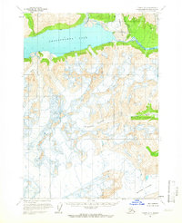
1958 · Tyonek A-7
USGS Topo · 1:63,360

1958 · Kenai
USGS Topo · 1:250,000