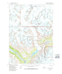
1958 Map of Kenai D-8
USGS Topo · Published 1988About this map
Lake Clark Pass serves as the focal point of this 1950s era survey, illustrating a critical natural corridor through the Alaska Range. The geography is defined by high-altitude ice and glacial runoff, with the Alta Glacier feeding into the surrounding drainage systems. The Tlikakila River and the Glacier Fork carve distinct paths through the steep terrain, while Summit Lake sits prominently near the height of the pass. This document reflects the landscape as it was recorded shortly before the formal establishment of conservation boundaries, which were later superimposed as the Lake Clark National Park and Lake Clark Wilderness. The mapping captures the precise flow of the North Fork Big River and the untouched nature of the Kenai Peninsula’s interior, offering a technical view of the region's hydrology and topography.
Find a feature on this map
9 named features on this map. Tap any name to fly to it.
Don’t see what you’re looking for? This feature index may not catch every label — zoom into the map to look around manually.
Map Details
Editions of this 1958 Kenai D-8 Map
2 editions found
Other maps of this area

1944 · Kenai
USGS Topo · 1:250,000

1946 · Lake Clark
USGS Topo · 1:250,000

1949 · Tyonek
USGS Topo · 1:250,000

1950 · Kenai
USGS Topo · 1:250,000

1951 · Lake Clark
USGS Topo · 1:250,000

1951 · Tyonek
USGS Topo · 1:250,000

1951 · Lime Hills
USGS Topo · 1:250,000

1958 · Kenai D-8
USGS Topo · 1:63,360

1958 · Kenai C-8
USGS Topo · 1:63,360

1958 · Kenai D-7
USGS Topo · 1:63,360