
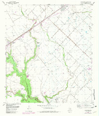
1953 Map of Kendleton
USGS Topo · Published 1954About this map
The San Bernard River and Turkey Creek define the low-lying geography of this 1950s survey at the boundary of Fort Bend and Wharton Counties. The land is characterized by an extensive network of human engineering, including a Pumping Station, numerous ditches, levees, and pipe lines that manage the waterways across Blossom Prairie. Historically significant features are clearly marked, most notably a Historical Marker designating the site of a Mexican Army encampment along the creek.
Find a feature on this map
27 named features on this map. Tap any name to fly to it.
Don’t see what you’re looking for? This feature index may not catch every label — zoom into the map to look around manually.
Map Details
Editions of this 1953 Kendleton Map
2 editions found
Other maps of this area

1950 · Houston
USGS Topo · 1:250,000

1953 · Needville
USGS Topo · 1:24,000

1953 · Guy
USGS Topo · 1:24,000

1953 · Wharton
USGS Topo · 1:24,000

1953 · Hungerford
USGS Topo · 1:24,000

1953 · Boling
USGS Topo · 1:24,000

1953 · Seguin
USGS Topo · 1:250,000

1955 · Richmond
USGS Topo · 1:62,500

1956 · Wallis
USGS Topo · 1:62,500

1956 · Houston
USGS Topo · 1:250,000