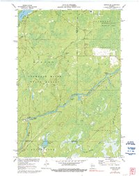
1971 Map of Kennan NW
USGS Topo · Published 1992About this map
The South Fork Flambeau River carves a winding path through the heart of the Flambeau River State Forest, defining a landscape of wetlands and waterpower. This 1971 survey reveals the river's character through its many named obstacles, including Big Bull Rapids, Cornsheller Rapids, and Bergeron Rapids, which historically influenced river transit and early logging operations. To the north, the Kimberly-Clark Wildlife Area represents a significant managed conservation tract alongside Connors Lake. Southward, the creation of the Skinner Creek Flowage and the presence of a Cranberry Bog illustrate how water management and natural resources shaped the local geography. The map also records specialized land uses like the Camp Flambeau campground and the Price Creek Spring, providing a detailed look at this Sawyer County wilderness before further modern development.
Find a feature on this map
41 named features on this map. Tap any name to fly to it.
Don’t see what you’re looking for? This feature index may not catch every label — zoom into the map to look around manually.
Map Details
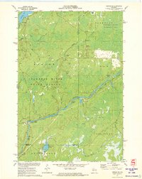
Editions of this 1971 Kennan NW Map
2 editions found
Other maps of this area

1941 · Kennan
USGS Topo · 1:48,000

1941 · Kennedy
USGS Topo · 1:48,000

1944 · Draper
USGS Topo · 1:48,000

1945 · Kennedy
USGS Topo · 1:48,000

1945 · Kennan
USGS Topo · 1:48,000

1945 · Ingram
USGS Topo · 1:48,000

1947 · Ingram
USGS Topo · 1:48,000

1947 · Draper
USGS Topo · 1:48,000

1953 · Rice Lake
USGS Topo · 1:250,000

1959 · Rice Lake
USGS Topo · 1:250,000