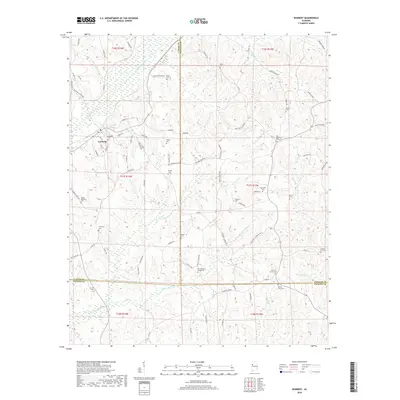
2018 Map of Kennedy
USGS Topo · Published 2018About this map
Kennedy serves as the central hub of this 2018 survey, positioned where the borders of Lamar, Fayette, and Pickens counties converge. The town's grid is defined by streets like Hill St and Porter St, surrounded by a landscape carved by a dense network of waterways including Luxapallila Creek and Coal Fire Creek. For those tracing local families, the map provides precise locations for over a dozen burial grounds, ranging from the central Kennedy Cemetery to more remote sites like Higdon Memorial Cemetery and New Wesley Chapel Cemetery. The terrain is characterized by winding rural routes such as County Road 49 and Mt Carmel Road, which connect disparate homesteads and family landmarks across the tripartite county line, illustrating the enduring rural settlement patterns of this West Alabama region.
Find a feature on this map
87 named features on this map. Tap any name to fly to it.
Don’t see what you’re looking for? This feature index may not catch every label — zoom into the map to look around manually.
Map Details
Editions of this 2018 Kennedy Map
This is the sole edition of this map. No revisions or reprints were ever made.
Other maps of this area

1953 · Birmingham
USGS Topo · 1:250,000

1953 · West Point
USGS Topo · 1:250,000

1956 · Birmingham
USGS Topo · 1:250,000

1957 · Birmingham
USGS Topo · 1:250,000

1958 · West Point
USGS Topo · 1:250,000

1963 · West Point
USGS Topo · 1:250,000

1967 · Brownville
USGS Topo · 1:24,000

1967 · Newtonville
USGS Topo · 1:24,000

1967 · Hightogy
USGS Topo · 1:24,000

1967 · Kennedy
USGS Topo · 1:24,000