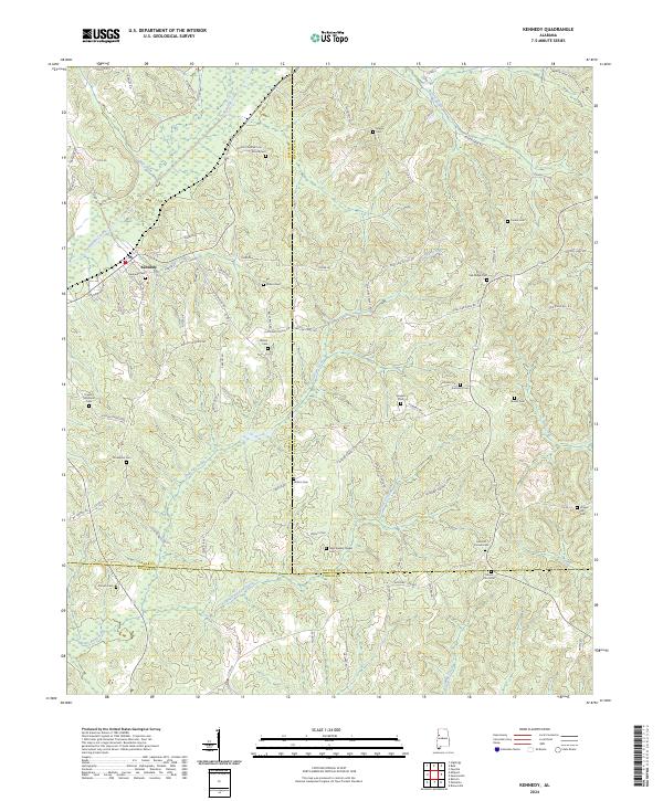
2024 Map of Kennedy
USGS Topo · Published 2024About this map
Kennedy serves as the central hub of this West Alabama landscape, situated near the headwaters of Luxapallila Creek. The area is characterized by a dense network of country roads, including Co Rd 49 and Co Rd 51, which connect numerous small family and community burial grounds. These sites, such as Moore Cem, Wilson Cem, and Oak Ridge Cem, provide a rich spatial record for genealogical research in this rural portion of Lamar and Fayette Counties. The terrain is defined by the drainage basins of Coal Fire Creek and Little Coal Fire Creek, which flow southward toward the Pickens County line. Distinctive community landmarks like New Wesley Chapel Cem and Ashcraft Corner illustrate the enduring social and religious geography of the region, where historical property lines and township boundaries still shape the local infrastructure.
Find a feature on this map
91 named features on this map. Tap any name to fly to it.
Don’t see what you’re looking for? This feature index may not catch every label — zoom into the map to look around manually.
Map Details
Editions of this 2024 Kennedy Map
This is the sole edition of this map. No revisions or reprints were ever made.
Other maps of this area

1953 · Birmingham
USGS Topo · 1:250,000

1953 · West Point
USGS Topo · 1:250,000

1956 · Birmingham
USGS Topo · 1:250,000

1957 · Birmingham
USGS Topo · 1:250,000

1958 · West Point
USGS Topo · 1:250,000

1963 · West Point
USGS Topo · 1:250,000

1967 · Brownville
USGS Topo · 1:24,000

1967 · Newtonville
USGS Topo · 1:24,000

1967 · Hightogy
USGS Topo · 1:24,000

1967 · Kennedy
USGS Topo · 1:24,000