
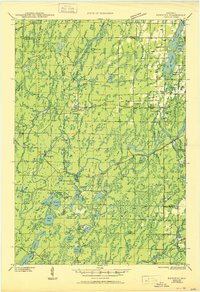
1945 Map of Kennedy
USGS Topo · Published 1945About this map
The Northwoods of Wisconsin are depicted here in the early 1940s, a landscape defined by the winding Lake Flambeau and the intense timber and rail activity of the era. The Chicago and Northwestern railroad cuts through the center of the sheet, connecting the small settlements of Kennedy and Kaiser to the wider region. This period shows a transition from the logging heyday toward conservation, with the Chequamegon National Forest and Flambeau River State Forest covering vast tracts of the terrain.
Find a feature on this map
84 named features on this map. Tap any name to fly to it.
Don’t see what you’re looking for? This feature index may not catch every label — zoom into the map to look around manually.
Map Details
Editions of this 1945 Kennedy Map
2 editions found
Other maps of this area

1940 · Butternut
USGS Topo · 1:48,000

1941 · Park Falls
USGS Topo · 1:48,000

1941 · Kennan
USGS Topo · 1:48,000

1941 · Kennedy
USGS Topo · 1:48,000

1941 · Phillips
USGS Topo · 1:48,000

1942 · Glidden
USGS Topo · 1:48,000

1942 · Clam Lake
USGS Topo · 1:48,000

1943 · Park Falls
USGS Topo · 1:48,000

1943 · Philliips
USGS Topo · 1:48,000

1944 · Draper
USGS Topo · 1:48,000