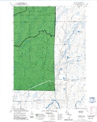
1970 Map of Kennedy
USGS Topo · Published 1972About this map
The Flambeau River winds through this northern Wisconsin landscape, marking a transition between the Flambeau River State Forest and the vast Chequamegon National Forest. This 1970s survey documents a region defined by managed timberlands and glacial water bodies, including Lake Alice, Lake Annie, and Round Lake. The settlement of Kennedy sits at the junction of local logging infrastructure, serving as a focal point near Kemp Road.
Find a feature on this map
29 named features on this map. Tap any name to fly to it.
Don’t see what you’re looking for? This feature index may not catch every label — zoom into the map to look around manually.
Map Details
Editions of this 1970 Kennedy Map
3 editions found
Other maps of this area

1941 · Kennedy
USGS Topo · 1:48,000

1942 · Glidden
USGS Topo · 1:48,000

1942 · Clam Lake
USGS Topo · 1:48,000

1944 · Draper
USGS Topo · 1:48,000

1945 · Kennedy
USGS Topo · 1:48,000

1945 · Clam Lake
USGS Topo · 1:48,000

1945 · Glidden
USGS Topo · 1:48,000

1947 · Draper
USGS Topo · 1:48,000

1953 · Ashland
USGS Topo · 1:250,000

1953 · Rice Lake
USGS Topo · 1:250,000