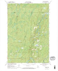
1970 Map of Kennedy
USGS Topo · Published 1992About this map
Kennedy sits at the heart of a densely forested landscape where the boundaries of Sawyer, Ashland, and Price counties converge. This 1970 snapshot reveals a region defined by its conservation and recreation networks, with the Chequamegon National Forest and Chippewa National Forest spanning the northern reaches. To the south, the Flambeau River winds through the Flambeau River State Forest, supported by infrastructure like the Gaging Station and a dedicated Snowmobile Trail for winter access.
Find a feature on this map
29 named features on this map. Tap any name to fly to it.
Don’t see what you’re looking for? This feature index may not catch every label — zoom into the map to look around manually.
Map Details
Editions of this 1970 Kennedy Map
3 editions found
Other maps of this area

1941 · Kennedy
USGS Topo · 1:48,000

1942 · Glidden
USGS Topo · 1:48,000

1942 · Clam Lake
USGS Topo · 1:48,000

1944 · Draper
USGS Topo · 1:48,000

1945 · Kennedy
USGS Topo · 1:48,000

1945 · Clam Lake
USGS Topo · 1:48,000

1945 · Glidden
USGS Topo · 1:48,000

1947 · Draper
USGS Topo · 1:48,000

1953 · Ashland
USGS Topo · 1:250,000

1953 · Rice Lake
USGS Topo · 1:250,000