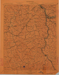
1903 Map of Kenova
USGS Topo · Published 1911About this map
The Ohio River and Big Sandy River serve as the primary conduits for settlement and industry at this tri-state junction of Kentucky, Ohio, and West Virginia. Commercial activity is anchored by the Norfolk & Western RR and the Chesapeake & Ohio RR, which trace the riverbanks through towns like Kenova, Ceredo, and Ashland. The interior landscape of the Kenova quadrangle is defined by a dense network of creek valleys, where small communities such as Argillite, Danleyton, and Bellefont established themselves long before modern highway expansion. Local landmarks like the Means Tunnel and Roundbottom Church provide specific points of interest for historical research. The convergence of Levisa Fork and Tug Fork illustrates the reliance on river navigation and rail transport that once dominated the regional economy, while many smaller branch labels like Cedar Run and Whites Creek mark the early homesteads of the Appalachian foothills.
Find a feature on this map
248 named features on this map. Tap any name to fly to it.
Don’t see what you’re looking for? This feature index may not catch every label — zoom into the map to look around manually.
Map Details
Editions of this 1903 Kenova Map
5 editions found

Other maps of this area

1886 · Prestonsburg
USGS Topo · 1:125,000

1887 · Warfield
USGS Topo · 1:125,000

1889 · Salyersville
USGS Topo · 1:125,000

1891 · Salyersville
USGS Topo · 1:125,000

1891 · Warfield
USGS Topo · 1:125,000

1892 · Prestonsburg
USGS Topo · 1:125,000

1892 · Huntington
USGS Topo · 1:125,000

1898 · Huntington
USGS Topo · 1:125,000

1898 · Ironton
USGS Topo · 1:62,500

1899 · Salyersville
USGS Topo · 1:125,000