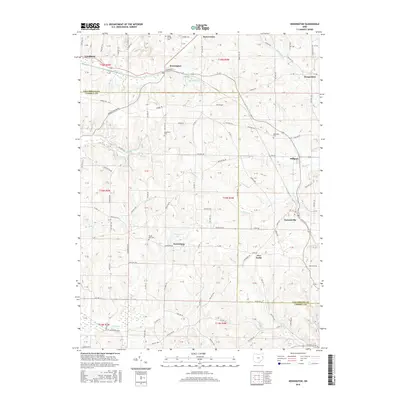
2016 Map of Kensington
USGS Topo · Published 2016About this map
The W & Le RR corridor anchors this portion of eastern Ohio, connecting the settlements of Kensington and Summitville. The landscape is a patchwork of small communities and rural acreage defined by the winding paths of Sandy Cr and the Muddy Fork. A strong sense of local heritage is evident in the numerous burial grounds scattered across the townships, including the Sandy Springs Cem in the north and the Glade Run Cem near Norristown.
Find a feature on this map
135 named features on this map. Tap any name to fly to it.
Don’t see what you’re looking for? This feature index may not catch every label — zoom into the map to look around manually.
Map Details
Editions of this 2016 Kensington Map
This is the sole edition of this map. No revisions or reprints were ever made.
Other maps of this area

1905 · Salineville
USGS Topo · 1:62,500

1909 · Alliance
USGS Topo · 1:62,500

1909 · Lisbon
USGS Topo · 1:62,500

1910 · Carrollton
USGS Topo · 1:62,500

1912 · Carrollton
USGS Topo · 1:62,500

1951 · Canton
USGS Topo · 1:250,000

1953 · Canton
USGS Topo · 1:250,000

1957 · Canton
USGS Topo · 1:250,000
1959 · Hanoverton
USGS Topo · 1:24,000
1959 · Carrollton
USGS Topo · 1:24,000