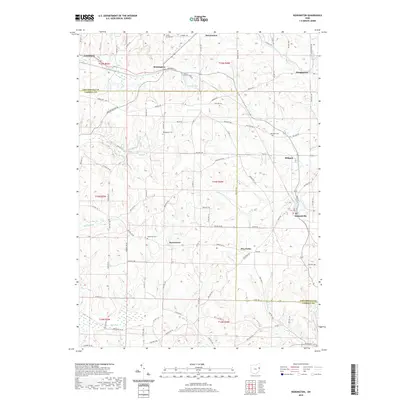
2019 Map of Kensington
USGS Topo · Published 2019About this map
Hanoverton and the surrounding township lands of Columbiana County and Carroll County are defined by a complex network of creeks and small farming settlements. The landscape is deeply etched by the courses of Sandy Creek, Brush Creek, and the southern Still Fork, creating a topography that influenced the placement of early routes like Railroad Street and Marble Road. Small communities and named crossroads such as Kensington, Summitville, and Millport serve as local anchors, while the presence of several established burial grounds, including Sandy Springs Cemetery and Bethesda Cemetery, provides significant genealogical touchstones for families in this corner of eastern Ohio.
Find a feature on this map
98 named features on this map. Tap any name to fly to it.
Don’t see what you’re looking for? This feature index may not catch every label — zoom into the map to look around manually.
Map Details
Editions of this 2019 Kensington Map
This is the sole edition of this map. No revisions or reprints were ever made.
Other maps of this area

1905 · Salineville
USGS Topo · 1:62,500

1909 · Alliance
USGS Topo · 1:62,500

1909 · Lisbon
USGS Topo · 1:62,500

1910 · Carrollton
USGS Topo · 1:62,500

1912 · Carrollton
USGS Topo · 1:62,500

1951 · Canton
USGS Topo · 1:250,000

1953 · Canton
USGS Topo · 1:250,000

1957 · Canton
USGS Topo · 1:250,000
1959 · Hanoverton
USGS Topo · 1:24,000
1959 · Carrollton
USGS Topo · 1:24,000