2023 Map of Kensington
USGS Topo · Published 2023About this map
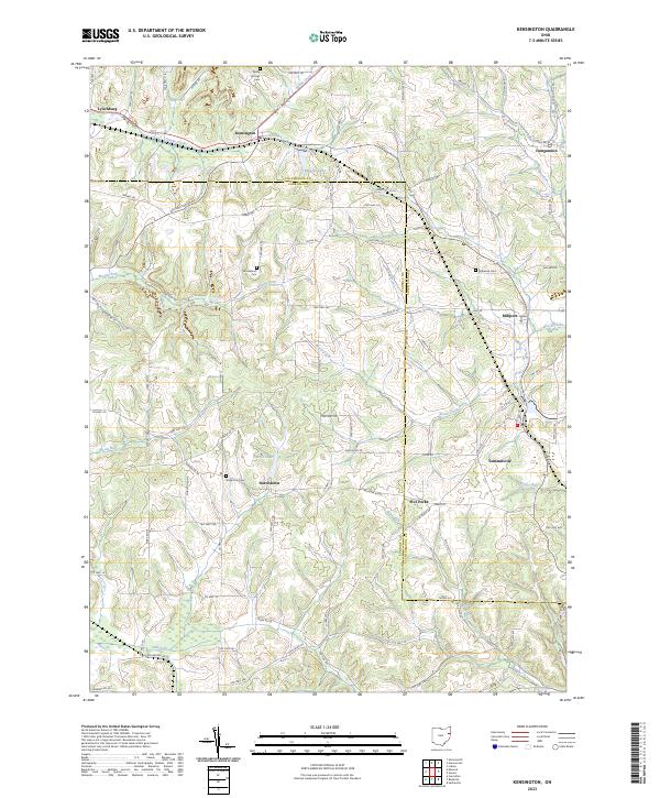
Kensington sits at the junction of several rural townships where the borders of Carroll and Columbiana counties meet. The landscape is defined by the winding course of Sandy Creek in the north and the headwaters of Still Fork in the south, creating a dissected terrain of ridges and valleys. Small historic settlements such as Dungannon, Millport, and Summitville are scattered across the quadrangle, connected by an intricate network of local routes like Tunnel Hill Rd and Laughlin Mill Rd. This 2023 survey illustrates a region where land use remains primarily agricultural and residential, punctuated by small bodies of water like Manfull Lake and France Lake. For genealogists, the map identifies several key burial sites including Sandy Springs Cem, Roudebush Cem, and Bethesda Cem, which serve as permanent markers of the families who settled these rural crossroads.
Find a feature on this map
95 named features on this map. Tap any name to fly to it.
Don’t see what you’re looking for? This feature index may not catch every label — zoom into the map to look around manually.
Map Details
Editions of this 2023 Kensington Map
This is the sole edition of this map. No revisions or reprints were ever made.
Historical Maps of Millport Through Time
3 maps found