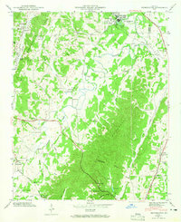
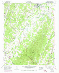
1946 Map of Kensington
USGS Topo · Published 1965About this map
Chickamauga and its surrounding agricultural valleys are captured here in 1946, a landscape defined by the parallel ridges of Lookout Mountain and Missionary Ridge. The topography dictates the path of human settlement, with the Central of Georgia Railroad and Georgia Highway 27 running north-to-south through the gaps. This area of Walker County shows a high density of rural institutions, including the Gordon Lee Sch, Garrett Ch, and Old Bethel Ch, alongside numerous family-named landmarks like Phillips Spring and the Bailey Cem. The drainage patterns of West Chickamauga Creek and Crawfish Creek are visible as they wind through Straight Gut Valley, supporting sites like Hall Mill. This map offers a detailed view of the rural Georgia landscape before postwar suburban expansion, preserving the locations of springs such as Wright Mineral Spring and geographic features like Catlett Gap.
Find a feature on this map
54 named features on this map. Tap any name to fly to it.
Don’t see what you’re looking for? This feature index may not catch every label — zoom into the map to look around manually.
Map Details
Editions of this 1946 Kensington Map
6 editions found

Other maps of this area

1886 · Ringgold
USGS Topo · 1:125,000

1892 · Ringgold
USGS Topo · 1:125,000

1935 · Catlett
USGS Topo · 1:24,000

1935 · East Ridge
USGS Topo · 1:24,000

1935 · Durham
USGS Topo · 1:24,000

1935 · Nickajack Gap
USGS Topo · 1:24,000

1936 · Kensington
USGS Topo · 1:24,000

1936 · Hooker
USGS Topo · 1:24,000

1936 · Estelle
USGS Topo · 1:24,000

1936 · Fort Oglethorpe
USGS Topo · 1:24,000