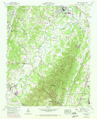
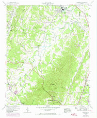
1946 Map of Kensington
USGS Topo · Published 1972About this map
Chattanooga Valley and the steep eastern face of Lookout Mountain dominate this mid-century portrait of Walker County. The local economy and social fabric of the era are centered around the rail lines of the Tennessee Alabama and Georgia railroad and the town of Chickamauga, where the Gordon Lee Sch and Crawfish Spring Lake served as community focal points. The map documents a landscape of scattered rural settlements like Noble and Kensington, interspersed with numerous family-named burial grounds including Owings Cem, Bailey Cem, and Porter Cem. The presence of industrial and agricultural sites such as Hall Mill along with natural landmarks like Horseshoe Cave illustrates a period of transition, where traditional southern mountain farming and milling began to interface with modern infrastructure like the Scenic Highway.
Find a feature on this map
57 named features on this map. Tap any name to fly to it.
Don’t see what you’re looking for? This feature index may not catch every label — zoom into the map to look around manually.
Map Details
Editions of this 1946 Kensington Map
6 editions found

Other maps of this area

1886 · Ringgold
USGS Topo · 1:125,000

1892 · Ringgold
USGS Topo · 1:125,000

1935 · Catlett
USGS Topo · 1:24,000

1935 · East Ridge
USGS Topo · 1:24,000

1935 · Durham
USGS Topo · 1:24,000

1935 · Nickajack Gap
USGS Topo · 1:24,000

1936 · Kensington
USGS Topo · 1:24,000

1936 · Hooker
USGS Topo · 1:24,000

1936 · Estelle
USGS Topo · 1:24,000

1936 · Fort Oglethorpe
USGS Topo · 1:24,000