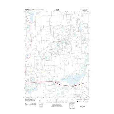
2011 Map of Kent Lake
USGS Topo · Published 2011About this map
Kent Lake and the surrounding basin define this landscape northwest of Detroit, where complex glacial hydrology has created a dense concentration of water bodies. The Huron River flows through a series of interconnected lakes, including Island Lake, Briggs Lake, and Wildwing Lake, supporting established recreation areas like Camp Dearborn and the Kensington Metropark Golf Course. The map reveals a transition from these recreational corridors to residential developments near Sears Lake and Honeywell Lake. For genealogists and local historians, several small burial grounds are preserved across the terrain, from the Kensington Baptist Church Cemetery near the river to the Bird Cemetery and Woodruff Farm Cemetery. Significant infrastructure such as the New Hudson Airport and Hynes Field provide aerial access to this lake-heavy region, while the prominent ridge known as The Bluffs offers a distinct vertical contrast to the low-lying wetlands and creek systems like Mann Creek and Spring Mill Creek.
Find a feature on this map
162 named features on this map. Tap any name to fly to it.
Don’t see what you’re looking for? This feature index may not catch every label — zoom into the map to look around manually.
Map Details
Editions of this 2011 Kent Lake Map
This is the sole edition of this map. No revisions or reprints were ever made.
Other maps of this area

1902 · South Lyon
USGS Topo · 1:62,500

1902 · Dexter
USGS Topo · 1:62,500

1904 · Ann Arbor
USGS Topo · 1:125,000

1906 · Dexter
USGS Topo · 1:62,500

1906 · South Lyon
USGS Topo · 1:62,500

1907 · Howell
USGS Topo · 1:62,500

1908 · Ann Arbor
USGS Topo · 1:125,000

1909 · Howell
USGS Topo · 1:62,500

1909 · Milford
USGS Topo · 1:62,500

1936 · Wixom
USGS Topo · 1:31,680
Featured Places
- Lyon Charter Township, MI
- Green Oak Charter Township, MI
- Highland Charter Township, MI
- Brighton Charter Township, MI
- Milford Charter Township, MI