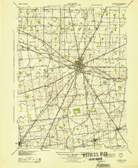
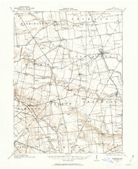
1944 Map of Kenton
USGS Topo · Published 1944About this map
The Scioto River and Blanchard River headwaters define the drainage of this Hardin County landscape, where the town of Kenton serves as a central hub for rail and road transit. This 1944 survey, updated from earlier field work using aerial photography, illustrates a highly developed agricultural grid dotted with dozens of local schoolhouses such as Brush College, Eagle Sch, and Opossum Sch. A significant portion of the eastern landscape is designated as Virginia Military Land, a legacy of early American land grants that influenced local surveying patterns.
Find a feature on this map
97 named features on this map. Tap any name to fly to it.
Don’t see what you’re looking for? This feature index may not catch every label — zoom into the map to look around manually.
Map Details
Editions of this 1944 Kenton Map
This is the sole edition of this map. No revisions or reprints were ever made.
Other maps of this area
1905 · Arlington
USGS Topo · 1:62,500
1907 · Bluffton
USGS Topo · 1:62,500
1907 · Arlington
USGS Topo · 1:24,000
1907 · Upper Sandusky
USGS Topo · 1:62,500
1913 · Alger
USGS Topo · 1:48,000
1913 · Bellefontaine
USGS Topo · 1:48,000
1913 · East Liberty
USGS Topo · 1:62,500
1913 · Richwood
USGS Topo · 1:62,500
1915 · Alger
USGS Topo · 1:62,500
1915 · Bellefontaine
USGS Topo · 1:62,500