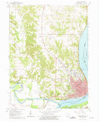
1964 Map of Keokuk
USGS Topo · Published 1975About this map
Keokuk occupies the strategic confluence of the Mississippi River and the Des Moines River in the mid-1960s, a location long defined by its tri-state geography and river commerce. This survey details the urban core and its northern expansion, where the Chicago Burlington And Quincy and Chicago Rock Island And Pacific rail lines parallel the riverfront. The landscape is marked by significant cultural and commemorative sites, including the National Cemetery and the sprawling Oakland Cemetery near the city center.
Find a feature on this map
65 named features on this map. Tap any name to fly to it.
Don’t see what you’re looking for? This feature index may not catch every label — zoom into the map to look around manually.
Map Details
Editions of this 1964 Keokuk Map
Other maps of this area

1903 · Kahoka
USGS Topo · 1:125,000

1936 · Keokuk
USGS Topo · 1:62,500

1936 · Fort Madison
USGS Topo · 1:62,500

1949 · Wayland
USGS Topo · 1:24,000

1949 · Kahoka SE
USGS Topo · 1:24,000

1950 · Kahoka SE
USGS Topo · 1:24,000

1950 · Wayland
USGS Topo · 1:24,000

1950 · Keokuk
USGS Topo · 1:62,500

1958 · Burlington
USGS Topo · 1:250,000

1961 · Burlington
USGS Topo · 1:250,000