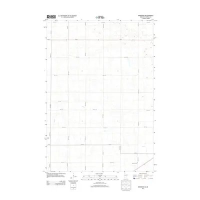
2013 Map of Kerkhoven SE
USGS Topo · Published 2013About this map
Hawk Cr meanders across this rural section of Chippewa County, defining the drainage patterns of an agricultural landscape shaped by a rectilinear grid of section roads. The terrain is dotted with small wetlands and depressions, characteristic of this part of Minnesota, while the human footprint is defined by isolated homesteads like Bluhm Farm. In the southeast corner, Sacred Heart Cem stands as a quiet marker of the local community's heritage near the intersection of 160th Ave SE and 5th St SE. Transportation through the area is anchored by Mn-40 and Co Hwy 2, which facilitate movement between the surrounding farmsteads. This survey captures the enduring rural character of the region, where family-named landmarks and local cemeteries remain the primary cultural anchors.
Find a feature on this map
28 named features on this map. Tap any name to fly to it.
Don’t see what you’re looking for? This feature index may not catch every label — zoom into the map to look around manually.
Map Details
Editions of this 2013 Kerkhoven SE Map
This is the sole edition of this map. No revisions or reprints were ever made.
Other maps of this area

1953 · New Ulm
USGS Topo · 1:250,000

1953 · Saint Cloud
USGS Topo · 1:250,000

1957 · Saint Cloud
USGS Topo · 1:250,000

1957 · New Ulm
USGS Topo · 1:250,000

1958 · New Ulm
USGS Topo · 1:250,000

1958 · Saint Cloud
USGS Topo · 1:250,000

1958 · Murdock
USGS Topo · 1:24,000

1958 · Kerkhoven SE
USGS Topo · 1:24,000

1958 · Kerkhoven
USGS Topo · 1:24,000

1958 · Kerkhoven SW
USGS Topo · 1:24,000