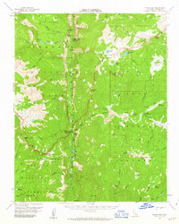
1956 Map of Kern Peak
USGS Topo · Published 1963About this map
The Kern River carves a deep north-south canyon through this high-altitude landscape of the High Sierra, separating the Chagoopa Plateau from the eastern peaks. During this mid-century period, the area served as a critical corridor for backcountry management and recreation, evidenced by the Kern Canyon Ranger Sta and the remote Tunnel Air Camp complete with its own Landing Strip. The map illustrates a transitional wilderness where geological landmarks like Window Cliffs and the volcanic features of Malpais meet a network of high meadows, including Sky Parlor Meadow and Big Whitney Meadow. This survey provides a distinct look at the infrastructure of the Sequoia National Park interior before modern environmental regulations shifted the management of such remote backcountry outposts and landing fields.
Find a feature on this map
91 named features on this map. Tap any name to fly to it.
Don’t see what you’re looking for? This feature index may not catch every label — zoom into the map to look around manually.
Map Details
Editions of this 1956 Kern Peak Map
4 editions found
Other maps of this area

1903 · Tehipite
USGS Topo · 1:125,000

1904 · Kaweah
USGS Topo · 1:125,000

1905 · Tehipite
USGS Topo · 1:125,000

1905 · Olancha
USGS Topo · 1:125,000

1907 · Olancha
USGS Topo · 1:125,000

1907 · Mt. Whitney
USGS Topo · 1:125,000

1909 · Kaweah
USGS Topo · 1:125,000

1919 · Mt. Whitney
USGS Topo · 1:125,000

1937 · Mt. Whitney
USGS Topo · 1:125,000

1937 · Kaweah
USGS Topo · 1:125,000